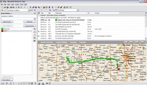
Microsoft Streets & Trips 2008 is a trip planner for Windows. This application allows you to plan your trips well ahead of time so you can relax and let nothing be randomly decided. Streets and Trips features a complete set of maps of the USA. All the streets and routes are presented in detail. You can define a start point and an end point, and the application will give you driving directions. You can alter those directions at any time by adding another stop, or changing the destination. This application also has plenty of points of interest from all over the country. You can search for restaurants, scenic places, hotels, cinemas, etc and they will appear on the map. If you want to go there, just right click the place you want to go and select it as a stop. New to the 2008 version are a great array of features that should allow you to make the best out of your trip. If you connect to the Internet, you can now search for places online and you can use keywords to find places. The new navigation screen goes full screen for you to take advantage of the application's directions. Microsoft Streets & Trips can now talk to you and tell you where to turn or how long you should be on a road for. It also brings a PocketPC application for you to take the maps on the go. If you pair it to a GPS, you have an excellent guidance system that will take you everywhere. If gas is a big concern for you, you can use the calculator, to know exactly how much gas it will take for you to get from A to B. This an excellent application that allows you to optimize your trips in a whole different way. The 2008 version tries to push GPS use to the top. The application comes bundled with a GPS receiver and a device that works to identify your position by means of FM broadcasts. Those allow you to make of your laptop a great positioning system. This year they tried to make things better by improving the use of Internet on the application. So, now you should be able to locate points of interest via the Internet and save them offline. The best thing about this application is that you don't need an Internet connection to use the maps.
Comments (1)